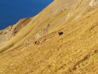
Oleg suggested hiking the Hardergrat on Sunday. It had been on his bucket list for a while and is sometimes referred to as the best hike in the world. The weather gods were friendly and so we agreed to meet on the Brienzer Rothorn in the morning. The logistics of getting there were a bit complicated: Alex would come up via cog wheel train from the South-West; Oleg, Shannon and Edu would join via cable car from the North; while I would hike up from the South-East.
Surprisingly enough this complex setup worked out flawlessly and we all met within half an hour of the appointed time. Glorious blue skies over a sea of clouds down in the valley promised a beautiful day. Edu, a paraglider pilot, admired the thermals along the ridge and contemplated the possibility of a "Catholic launch" - a very committing launch with no opportunity to abort. This brought me a fit of laughter ;-)
The ridge has been described thusly:
On the Hardergrat, you are forced to suspend your belief about what you think grass can do, and at what angles soil can actually stand. The Hardergrat is typically graded Swiss Alpine Club T5, a number usually reserved for mountaineering terrain where an ice axe is mandatory. The trail is often one foot wide on a two-foot-wide ridge top, and a slip off either side in many spots means a fall of thousands of feet. I wished several times for an ice axe and crampons, and we never once stepped on ice or snow.
And indeed it is extremely exposed and demands full concentration for almost the entire time of eight hours you spend on it. Slips and stumbles would have severe consequences. Or, as Oleg so eloquently phrased it: "I shat a few bricks along the way".
Even using the cable car it is quite a committing endeavor with few opportunities to bail. And long. You don't want to get caught in a thunderstorm or rain up there. Luckily conditions were nearly perfect. Except for a few muddy bits where the frozen ground thawed during the day it was dry.
I felt strong and was extremely motivated. After waiting on the first few summits it quickly became apparent that the group and I were going at a different pace. While I had already started out with the ambition of hiking the ridge from valley to valley instead of cable car to funicular, the idea had grown on me to extend it even further and do a full round trip. Thus we separated and I went ahead.
I didn't stop anymore before reaching the restaurant at Harder Kulm several hours and about 15 kilometers later. I overtook quite a few people on the ridge, but a couple attached themselves to my heels and stayed a few paces behind me for a full two hours or so. When we reached the restaurant they high-fived and limped on to the funicular. I was barely more than half way done at that point...
I descended towards the Brienzer lake and started my way back towards Brienz. Darkness had fallen and I had a long horizontal slog on asphalt ahead of me. When it became apparent that at this rate I wouldn't be home before 3 o'clock in the morning, I decided to shorten the boring bit by taking the train from Niederried. This cut about 9 kilometers out of the loop.
From the train station I still had to ascend a full 1200 meters to get back to my car which I had parked half way up the mountain in the morning. This was the only way to meet the others in time as there had been no earlier train connections and even as it was I had to sprint up the mountain in two hours for a distance that was supposed to take three. Anyway. It was dark now. The bright full moon from the early morning was now shrouded in fog. Finding the way back to the car became a bit of an issue and I went up the wrong side of a steep gorge. Added some bonus altitude of 150 meters or so.
I arrived back at the car just past eleven o'clock at night. A long day indeed. I had been going more or less continuously for 16 hours since seven in the morning. 20km and 1500m on the ridge and 35km and 1800m off, for a total of 55km and 3300m elevation gain and loss.
- Brienzer Rothorn (2348m)
- Schongütsch (2319m)
- Briefehörnli (2164m)
- Balmi (2141m)
- Tannhorn (2220m)
- Ällgäuwhoren (2047m)
- Schnierenhireli (2070m)
- Gummhoren (2040m)
- Blasenhubel (1965m)
- Wytlouwihoren (2106m)
- Augstmatthorn (2136m)
- Suggiture (2084m)
- Schönbüel (1807m)
- Roteflue (1730m)
- Harderkulm (1321m)
Oleg & gang - thanks for inviting me and apologies for running off - it was just too tempting an opportunity to pass on... Thank you for sharing your photos too - all the good ones are not from me ;-)


No comments:
Post a Comment