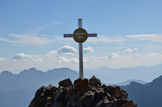
Bam! I'm back ;-) With a perfect weather forecast I decided to spend another night under an open sky in the alpine wilderness. A good decision it turned out to be! Starting in the village of Flums I intended to hike the ridge around the Schilstal as far as I could - ideally completing the entire horseshoe around the valley. In the end I had to make a choice between either bagging every summit and cheat by taking the cable car down or skipping on some peaks but complete the round in good style. I chose the latter. Always time to come back later and combine the "missing" summits with a different traverse.
After passing the initial inhabited areas I met only 3 people on the entire first day. The area felt really remote and really wild. Maybe the difficulty of the terrain added to that. It starts out on easy hiking trails but if you want to stay high you'll soon find yourself following vague tracks along steep drop offs. At one point I thought I had lost the way because the cliffs looked so forbidding and impassable. Only when I discovered a tiny sign mounted on the rock did I regain some confidence. The sign was mourning the death of two hikers who fell from that spot.
The section required some careful maneuvering and calm nerves. Attacking the climb head on turned out to be tricky as it got me into a leaned back position groping for holds on downward facing rock covered in grime. Better rethink that. In the end the solution was obvious and simply required stemming moves in the chimney. An awful lot of air below your ass though. Combined with the Hochgamatsch where I missed the approach (or so I hope - what I saw seemed irresponsible!) and a vertical needle of rock I was a bit spooked. Sitting on the summit of the Hochfinsler I decided to take it a little easier from now on and find a way further down. Dumbest decision of the entire trip. I lost 300m of altitude and had to stop on top of a 50m vertical cliff. On my coarse map this cliff had breaks that looked passable. In reality these breaks turned out to be near vertical and composed of loose gravel. No way. Unfortunately the cliff snakes on for kilometers as a sort of natural barrier. I followed it for a while but in the end just gave up and regained the ridge. Expensive detour.
Luckily the final section of the ridge, the Apöstel, turned out easier than expected. I have to concentrate much harder than I'm used to because the balance in my left foot is still way off. Just standing on one foot is a tricky exercise. A heavy backpack and complex ground don't help much either.
I try to find a bivy spot at the Lauifurggla. It is warm, but a chilly west wind is blowing. I know from past experience that wind is a much worse enemy than just cold temperature so I circle back and forth looking for a sheltered spot. I end up in the Prudell meadow. While my exact location isn't particularly protected, I now have an entire mountain between me and the primary wind direction. Helps.
Beautiful starry night sky. I should learn how to use my camera and take a picture of this some night. I'm standing on the first summit of the day at 7 o'clock the next morning. An easy and comfortable "cruising" ridge sees me up the Oxni at a quarter to eight. From there I descend and follow the Sardona World Heritage trail towards Spitzmeilen. It looks steep and forbidding but is rated a T4-5 with a scrambling section that is protected by chains and well marked. There's an SAC hut nearby and the Spitzmeilen counts as the local highlight. So it is that after almost a full day with no human contact I meet the first three souls on the summit - at which point it is almost at full capacity ;-) We chat a bit about the where from, where to and the surrounding mountains. I earn some credit for starting all the way down in the valley and sleeping outside.
I descend to the SAC hut where I gulp down a bowl of soup and half a liter of instant energy Coca Cola. From there it's an uneventful but very long hike back out to Flums. The lower I get the hotter the sun burns down on me. Towards the end I feel like I'm about to faint despite drinking like a horse and filling my hat with ice cold water on every stream I pass. Of course I haven't checked any schedules or transportation options in advance. Of course the outstanding Swiss public transportation only has me waiting for 3 minutes before offering a direct connection back home.
While I am still limping a bit a day later the foot has held up remarkably well. Also, this was the first trip after the accident that would count as demanding by most anybodys definition. I climbed about a dozen peaks (depending on what you consider an independent summit or just a bump on the ridge) in difficult T5 terrain, carrying an overnight pack. I'm very satisfied with the result - slowly clawing my way back to fitness!
- Sat: 19km, +2800m (!!), -1000m
- Sun: 24km, +900m, -2700m


No comments:
Post a Comment