2016-07-10

Mt Stuart (2870m) via West ridge (5.4)

Our original objective for the weekend was the Mt Baker North ridge. However, the weather was really bad and it didn't seem feasible to go. So we sat in KAF adventures' office and discussed our options with the founder and head guide Mick. We eventually settled to try a local rock climbing crag on Saturday and go for Mt Stuart on Sunday. Stuart is on the East side of the cascade range which enjoys drier weather.

We only climbed one route here - too wet.
This corner was much more fun!
Pearl Jam radio - how awesome is that?!
Not too shabby a campsite.

The poetically named "Exit 32" crag is well bolted and easily accessible by a short half hour hike. The first wall we tried was all wet and slimy, making the climbing all that much harder. So we went a bit further along the trail to a wall that is overhanging enough to stay mostly dry even in rain and climbed a few pitches there. Overall a pretty enjoyable experience and a good getting to know one another excercise. After all, Mick will be trusting us as his belayers later on the mountain. We found us a nice spot to pitch our tents along the Lake Ingalls trail and went to sleep early. Mick had to sleep on the rope and backpacks because he forgot to bring a mat ;-)

The trip nearly ended early when I broke through a snow bridge and fell into the Bergschrund for 1.5 meters or so.
This guy wasn't intimidated by us at all.
Mick, Sören, Marmot.

We headed up the trail around 4 in the morning. Mt Stuart is quite inaccessible, so we'd have to cross two passes in order to even reach the mountain. This is why Mick kept calling this "A Big Day!" and had never before climbed the mountain in a single push. This would become a recurring meme between the three of us: Mick told us that he'd typically set up a bivy about three hours short of the summit, camp there, and then climb the mountain. So Pawel and me kept exclaiming "bivy!" for every good bivy spot we found (and there were many). To which Mick would always respond: "Not even close yet". Long day indeed. In the end the car to car round trip time would turn out to be around 21 hours after which we'd drive back to Seattle and go to the office the next morning.

Still on easy terrain on the approach.
Finally we've reached the mountain proper!

The mountain is huge and the route complex and convoluted. Says the guidebook:

"Without a rival as the crown peak in the central Cascades of Washington, Mount Stuart has been pronounced the single greatest mass of exposed granite in the United States...its northern and eastern faces are the alpine climax of the Wenatchee Mountains. They make a powerful impact on first sight...The mountaineering problems are magnified by the mountain's massive dimensions and its complexity." -- "Cascade Alpine Guide - Climbing and High Routes - Columbia River to Stevens Pass, Second Edition" by Fred Beckey.

"the route is long and complicated with many opportunities to get off route onto more difficult terrain. While a strong experienced party can complete the route in one day car to car from the Teanaway Trailhead, it is not uncommon for parties to have route finding problems and bivouac on the route or descent" -- summitpost.org

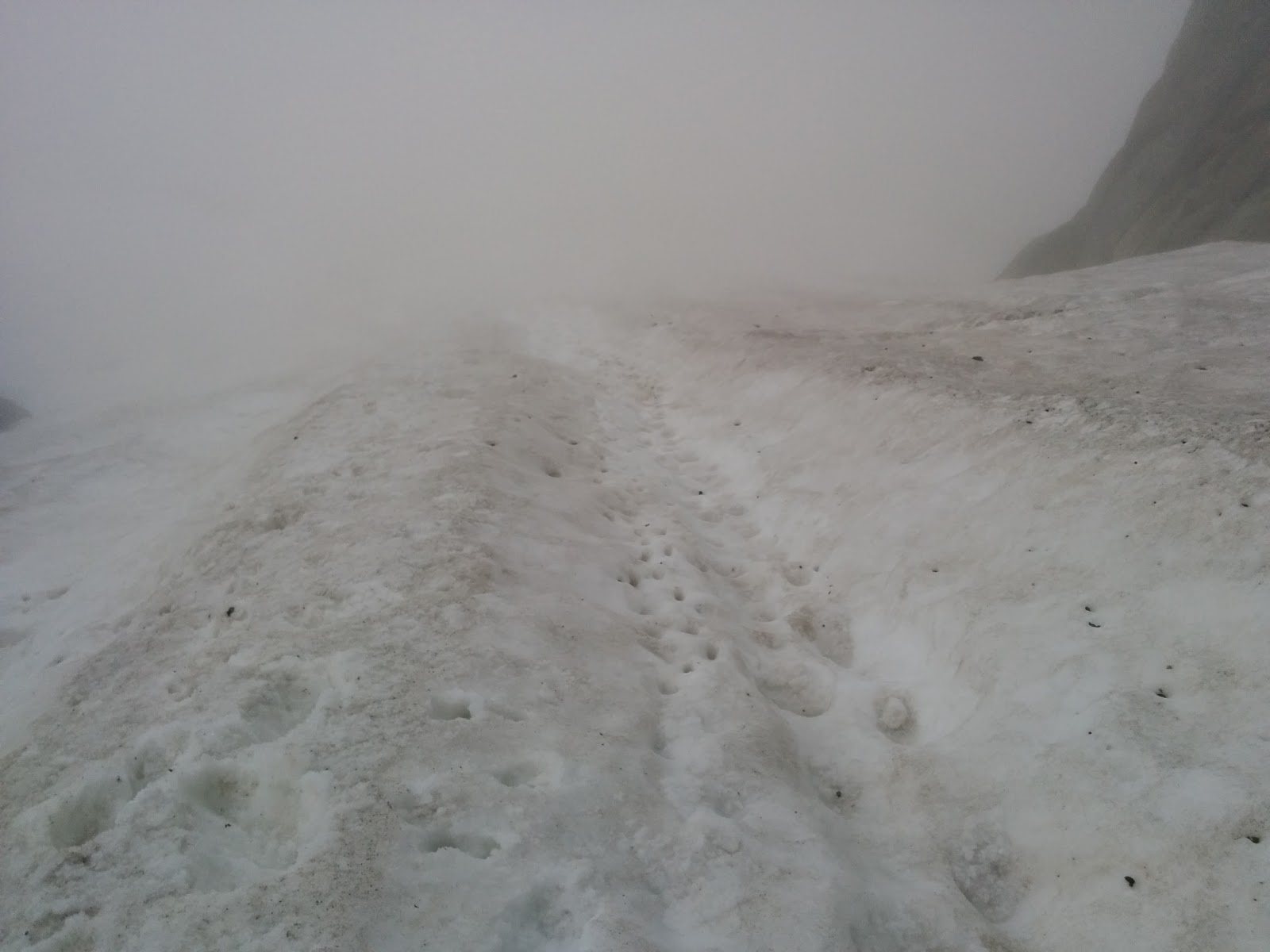
Visibility was shit most of the day because we were climbing in a cloud. Thus even Mick's navigational skills were tested and I'm pretty sure we deviated from the easiest line occasionally. The West ridge we were climbing is supposedly graded 5.4 climbing which translates to a 4a in the French system more commonly used in the alps. This is a grade I've climbed barefoot and hands-free before, thus it shouldn't pose any difficulty whatsoever. Not so here. The rock was wet and the crux section so difficult that Mick had to aid it by pulling on gear while leading it.

Mick leading into the difficult bit.
Nice balcony. A bad placement nearly made a pillar of rock as tall as a man collapse onto us.

At one point Pawel got completely stuck in a tricky sequence of moves. He's an endurance monster, but his most recent climbing experience before this weekend was 7 years in the past. We fumbled around for nearly an hour, trying to find a solution with stepping on slings and such. Pawel was about to give up and call it quits before I eventually managed to place a small cam in a crack that enabled me to hang off the wall and offer my shoulder as a foothold. This unblocked us and the rest of the route turned out much easier. Booked as a team building exercise ;-)

The way ahead? I completely lost any sense of direction and didn't even know which compass direction we were headed in anymore. Luckily Mick did (and used his iPhone GPS...).
"Bivy!"
Summit!
The gang.

Spirits were high and we went a little insane along the way (altitude? jet-lag? ;-)). After I related the story of Boaty McBoatface we took to naming everything after this scheme and we had Chilly McChillface and Slimy McSlimeface and so on. Mick was also really easy to get started chanting made up songs. You'd throw some random sentence fragments at him and he'd pick them up and turn them into a spontaneous nonsensical limerick. Good fun.

Finally clearing up a bit.
Easier, but weird terrain. Never encountered a sandy beach this steep before.

When we finally made it to the summit I got a good laugh out of the others when I proudly proclaimed that we had climbed "Mount... What is it called again?". The descent was long, but much easier than the ascent. We had to negotiate steep snow of about 40 degrees and a lot of scree and sandy slopes. Around 7pm the clouds finally cleared up enough for us to enjoy a view. From that point on it was still an endless slog over two passes back to the car. We did a lot of that in the pale moonlight, using our headtorches only once we were in the shade of the trees.

Using any opportunity for rest at this point...

All in all a fantastic outing. Thank you Mick for turning a rained out weekend into a truly remarkable experience and for trusting us with "A Big Day" like this.

~2774m up and down, ~30km

2016-07-03

Graue Wand (3172m) via Niedermann (5c+, 11 pitches, 405m)

Alex, Ilona, Vladimir and I head out to the parking lot Tätsch at 2272m at the Furka pass on Saturday night. My preferred solution would have been to watch the Germany vs Italy soccer match and leave on Sunday morning instead, but for some reason the others weren't particularly excited about getting up at 4 in the morning. So instead we pitch our tents in the dark and nearly zero visibility because we are in the middle of a cloud. Everything is wet from dew and the air saturated with moisture.

Me paying a charity visit to Ilona and Vladimir in the ghetto tent.
Morning. Visibility still shit. Everything still wet. Unclear whether climbing will even be possible at all.
Crossing a creek.

We allow ourselves a relatively leisurely start at 7 in the morning. The world is still shrouded in a wet fog and we need the wall to dry off before we can climb. So giving the sun a bit of a head start makes sense. The hike to the base of the wall takes us roughly two hours. The last bit leads up a steep snow field of about 40 degrees. I'm the only one who brought crampons, but they turn out to be unnecessary because there are already good steps and the snow is soft anyways. Thus the others mock me for my excess baggage.

Approaching the objective: the tallest rock wall in the center of the image. Our route starts at the top of the snow field right of the buttress.
Looking back down the snow field.
Scrambling up to the start of the route. Still can't see very much.

There's a party of four in front of us at the start of the climb, so we have to queue and wait. They've camped at the same site we did and arrived a few minutes earlier. The first pitch is thirty meters long and protected by only two bolts. It's also still slightly wet. The first climber starts a bit gung-ho after having a loud mouth with his friends. A sudden scream and the next instant he falls eight meters, crashing into the wall just above the ground next to his belayer. A close call. That could have gone really bad, especially considering the fact that they forgot to clip the anchor and there would have been the possibility to fall past his belay and take him down too. As it stands the party is just shell shocked and the climber hurt his leg and his elbow, temporarily losing all feeling in his hand. The two of them are too shaken to continue and return back to base.

It's clearing up!
"Our" massive chunk of granite.
Vladimir following in the first pitch.

Their friends are arduously slow crawling up the first two pitches. We are becoming impatient - at this rate the entire climb is in jeopardy. Luckily for us they decide to bail after the second pitch. The follower just wasn't up to it. A game of rock-papers-scissors decides that Alex and I will go first. Alex quickly disposes of the first pitch. He drops his cell phone from the top, while trying to take a picture. By some miracle it survives the fall with just a cracked screen.

Vladimir fighting an off-width while leading the second pitch.
The easier pitches were extremely run-out...
...and not all gear was trustworthy.

The climb is fantastic. The weather has turned out great in the end and the South facing wall dried off quickly. The rock is of superb quality and the climbing varied and of sustained difficulty. The entire route would likely be climbable as a trad route, plenty of cracks for "bomber" placements. As a consequence some parts are only sparsely protected with bolts.

I got to lead the "Ziegenrücken" pitch: arguably the most beautiful and aesthetic line of the entire climb. Relatively easy climbing (5b) on huge flakes with dramatic exposure.
Alex following on the "Ziegenrücken".
Ilona hanging around.

There are only two grassy 4a/4b pitches in the entire route. We link them into one with the nice consequence that each of us gets to lead 5 pitches total, alternating the lead at every anchor. Without the other party blocking us we make good progress and top out after about five hours. I could feel the altitude towards the end. At above 3000 meters I had to catch my breath every couple of moves.

How's that for exposure?
View towards the other side: the Damma glacier.
Alex celebrating the summit.

Alex doesn't waste much time and starts rappelling even before Ilona and Vladimir join us on the summit. We miss the official rappel route and have to do some annoying diagonal rappels in order to end up back at the start of the climb. If you lose your feet while traversing sideways you risk painful pendulum swings. Meanwhile, Ilona and Vladimir are on the proper rappel route and overtake us.

Happy!
Vladimir.
First of many rappels back to the start.

I take a brief moment during the rappel to collect some crystals from a "Strahler" cave. Crystal hunters have put in fixed ropes in a few places and have dug out cracks in the rock. Nice souvenir ;-) It takes about 8 rappel maneuvers over 400 meters to get back down. We make it back to our tents and the car at around half past seven in the evening. A fantastic day in great company - thanks everyone!

A "Strahler" (crystal hunter) cave.
Hanging in the void.